Student researcher
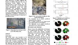
The research investigates the application of two emerging and independent terrestrial remote sensing technologies to ascertain burn severity of prescribed burns in dry sclerophyll forests of southeast Australia. The remote sensing instruments used are the HyperSpectral Radiometer (HSR) and Terrestrial Laser Scanner (TLS) while field based measures include fire temperature, fuel hazard and burn severity. While the HSR enables monitoring physiological response, the TLS helps quantify structural change in the landscape. These two technologies are being treated independently in this research. Broadly, this research will identify metrics derived from hyperspectral and terrestrial laser scanning data that best describe change produced in the landscape in response to the prescribed burns. Multi-temporal data will be captured pre- and post-burn to enable monitoring time-series vegetation recovery and burn severity. Four research questions are considered as follows: 1) What are the spectral changes observed in the fuels belonging to different vertical strata of an Australian dry sclerophyll forest in response to prescribed burns and when are they observed? 2) Which remotely sensed metrics obtained from hyperspectral datasets best ascertain burn severity in the landscape? 3) What metrics can be derived from terrestrial laser scanning data to detect structural changes in burnt landscapes? 4) Which TLS derived metric can be used to quantify different fire severities in the landscape in response to different fire treatments? Since this research is primarily a ground-based study using terrestrial remote sensing instruments, the scale at which data capture will take place will be very ‘fine’ as compared to air-borne imaging and LiDAR scanning. The advantage of such an approach especially from the hyperspectral remote sensing point of view is that it facilitates capture of pure spectra devoid of the ‘spectral mixing’ effects which is encountered with both air- and satellite-borne remote sensing. Another advantage is that it enables detailed data capture underneath a canopy. It has been acknowledged that it is extremely difficult to interpret and quantify changes in the understorey using airborne remote sensing technology.
| Year | Type | Citation |
|---|---|---|
| 2016 | Thesis | Measuring fire-induced change in the understorey of an Australian dry sclerophyll forest using remote sensing. (2016). at <https://researchbank.rmit.edu.au/view/rmit:161758> |


