PUBLICATIONS
Published works

Mapping bushfire hazard and impacts – final project report
| Title | Mapping bushfire hazard and impacts – final project report |
| Publication Type | Report |
| Year of Publication | 2020 |
| Authors | Yebra, M, van Dijk, A, Cary, GJ |
| Document Number | 616 |
| Date Published | 10/2020 |
| Institution | Bushfire and Natural Hazards CRC |
| City | Melbourne |
| Report Number | 616 |
| Keywords | Bushfire, hazard, impacts, mapping |
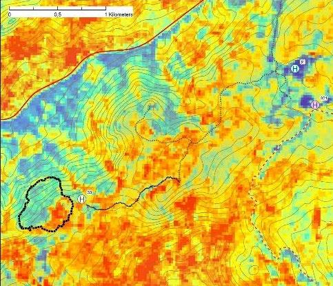
| Abstract | Fuel condition (e.g. moisture content, horizontal and vertical continuity and the quantity or load) affect flammability and therefore is a key determinant of the ease of ignition and the spread rate of a fire. Many research institutions and management services are investing an important amount of resources on field-based fuel condition monitoring to understand its dynamics and support operational fire management activities. However, field sampling is expensive and time-consuming, sometimes subjective and implies also a delay time until the data are processed and made available. The Bushfire & Natural Hazards CRC project ‘Mapping Bushfire Hazards and Impacts’ used cutting-edge technology to produce near-real-time spatial information on fuel condition, fire hazard and impact to support a wide range of fire risk management and response activities such as hazard reduction burning and pre-positioning firefighting resources and, in the longer term, the new Australian Fire Danger Rating System (AFDRS) given it considers fuel condition as ne of the key factors required to determine fire danger and support other decision -making. The first phase of this project (2014-2017) involved the parallel investigation of several promising data sources and methods that can be categorised as either ‘in-field’ (grassland curing on-ground sensors and ground-based LiDAR laser scanning for fuel structure characterisation) or ‘national-scale’ (the Australian Flammability Monitoring System-AFMS, and the High-resolution Fire Risk and Impact (HiFRI) model-data fusion framework) methods. Generally, information derived from the national-scale methods appeared to represent enough accuracy and better return on investment and generated greater interest among end-users. Consequently, over 2017-2020, this research project focused on ensuring the continuity of the AFMS but further developing the algorithms to estimate fuel moisture content (FMC), and through this, its acceptance and adoption. The AFMS provides information on FMC and flammability across Australia at 500m resolution every four days. It also displays information on soil moisture content near the surface (0-10 cm) and shallow soils (10-35 cm) as research outcomes from the project “Improving land dryness measures and forecast”. Our research project also improved estimates of litter FMC by incorporating the effect of soil moisture content in existing physics-based models, developed a methodology to map fuel loads using satellite data and an objective and observation-based approach to assess fire danger that considers spatial data on the occurrence of actual fires as well as on fire factors that are already routinely produced every day for Australia. The improved litter FMC, fuel load and fire danger retrieval algorithms and products derived from this project are not yet included in the AFMS nor generated at near real-time and across Australia. Further research and development is needed to make that step and providing landscape scale, cost-effective way to comprehensively monitor fuel condition and fire danger at such a broad scale. Consequently, future research should focus on developing a multi-sensor system that will display daily information on fire danger and fuel condition from whatever satellite sensor has collected an image over Australia, including high-resolution satellite imagery. This will improve the temporal and spatial resolution of the information we currently provide at the AFMS that will allow the identification of, for example, local fuel moisture gradients in the landscape that are currently not identifiable using the 500m pixel resolution of the product we currently serve in the AFMS. The use of high-resolution satellite imagery will provide an unprecedented level of detail and accuracy when estimating fuel condition, bringing the system closer to use in operations. However, the data volumes and large compute resources required to store and generate these high-resolution products becomes a challenge. Consequently, future research should also focus on developing an alternative methodology for computing fuel condition that can provide up to date estimations by reducing the required storage and computing resources using state-of-the-art artificial intelligence algorithms. |
| Refereed Designation | Refereed |
Published Works


