PUBLICATIONS
Published works

Integrated urban planning for natural hazard mitigation – final project report
| Title | Integrated urban planning for natural hazard mitigation – final project report |
| Publication Type | Report |
| Year of Publication | 2020 |
| Authors | March, A, de Moraes, LNogueira |
| Document Number | 635 |
| Date Published | 12/2020 |
| Institution | Bushfire and Natural Hazards CRC |
| City | Melbourne |
| Report Number | 635 |
| Keywords | integrated, mitigation, natural hazard, urban planning |
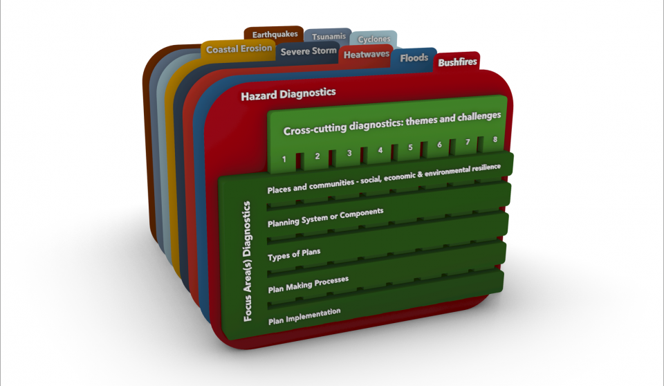
| Abstract | Context Urban planning systems have considerable potential to modify the impacts of natural hazards upon the built environment, humans and associated systems. With the increased frequency of natural hazards due to climate change and increased exposure to hazards due to population growth pressures, especially in the urban-rural interface, there are also increased consequences for human settlements and likely exacerbation of the challenges associated with natural hazard impact. In this context, this project sought to understand the limits and potentials of integrated urban planning for natural hazard mitigation in Australia, and the ways in which key planning processes for risk-based decision-making in the built environment can be improved. By doing so, it identified many gaps in the ways we currently seek to integrate urban planning and natural hazard risk management. The primary questions posed by this research project were: PQ1 – What are the limits and potentials of integrated urban planning for natural hazard mitigation in Australia? PQ2 – How can key planning processes for risk-based decision making in the built environment be improved at local and state level, including generalizable and adaptable model processes and codes with practical illustrative cases? Method The project comprised 3 sequential stages that resulted in the development of diagnostic tools to assess and improve the integration of urban planning and natural hazard mitigation in Australia. The first stage–Mapping Current Knowledge, Best Practice and Challenges–established an analytical framework to assess integration based on current knowledge, best practice and challenges. Using desktop research and end-user workshops, core integration principles were identified. In the second stage–Assessing Australian Planning and Ways Forward–the set of integration principles was refined through its application to past Australian inquiries into natural hazard events. An analytical framework for assessing integration was also developed and diagrammatically represented to illustrate and map critical variables for the integration of Urban Planning and Natural Hazard Mitigation. The third stage–Applying and Generating Knowledge in New Ways–applied and generated knowledge by undertaking an assessment of urban planning and natural hazard mitigation in two Australian case studies. In consultation with end-users, this assessment targeted proposed land use planning reforms in South Australia and a historical case of edge development in Metropolitan Melbourne in Victoria. Findings from these case studies informed the development of critical frameworks for best practice comprising three sets of diagnostic tools. Learnings and findings Learnings were captured in a set of scalable and adaptable diagnostic tools that are part of critical frameworks for best practice in integrating urban planning and natural hazard mitigation in Australia. These diagnostic tools allow assessment of integration and risk management across urban planning and emergency management systems and processes. This set of tools is the final product for this research project and the utilisation output delivered to end-users. This output represents a comprehensive understanding of the potentials and limits of urban planning systems when it comes to disaster risk reduction. It allows for a range of new ways forward to fully utilise and integrate urban planning with natural hazard mitigation actions and outcomes. Broadly, these diagnostic tools suggest that a comprehensive assessment of integration of urban planning and natural hazard mitigation should include consideration of
Utilisation This project is in its first three-year cycle, so it was not able to move into utilisation. However, the outcomes of the work provide an ability to understand, critique and improve urban planning’s influence and impact on risk reduction to natural hazards, providing many new ways forward. Therefore, there is great potential for the utilisation of the critical model developed in the research to assess and guide reform in processes of land use planning in existing and future settlements. In particular, modifying the processes of state and local government during planning decision-making is likely to yield significant impact. The development of illustrative critical and explanatory understandings of the importance and application of urban planning as a tool for disaster risk reduction is in and of itself a significant output that can be utilised. Many of the project findings have been included in the AIDR Handbook “Land Use Planning for Disaster Resilient Communities” (March & Gonzalez-Mathiesen, 2020) and have informed submissions to the Royal Commission into National Natural Disaster Arrangements (Stanley et al., 2020)and to the Inquiry into the 2019-2020 Victorian Fire Season (Stanley et al., 2020,embargoed). There are many potential areas for ongoing utilisation. These fall under the following broad categories:
|
| Refereed Designation | Refereed |
Published Works


