Student researcher
Land-based sensors can often be subject to damage or malfunction in a natural hazard, and direct measurement of flood levels can also be a dangerous exercise. This study, completed in December 2017, applied technology developments, including those gathered from recent space missions, to inform the flood modelling process. In particular, the role of errors within the modelling process was explored to give an understanding of the confidence provided by any predictions.
| Year | Type | Citation |
|---|---|---|
| 2018 | Journal Article | Identification of hydrologic models, optimized parameteres, and rainfall inputs consistent with in situ streamflow and rainfall and remotely sensed soil moisture. Journal of Hydrometeorology 19, (2018). |
| 2017 | Thesis | Estimating areal rainfall time series using input data reduction, model inversion, and data assimilation. Monash University 146 (2017). at <http://users.monash.edu.au/~jpwalker/theses/AshleyWright.pdf> |
| 2016 | Conference Paper | Research proceedings from the 2016 Bushfire and Natural Hazards CRC and AFAC conference. Bushfire and Natural Hazards CRC & AFAC annual conference 2016 (Bushfire and Natural Hazards CRC, 2016). |
| 2015 | Conference Paper | Research proceedings from the 2015 Bushfire and Natural Hazards CRC & AFAC conference. Bushfire and Natural Hazards CRC & AFAC annual conference 2015 (Bushfire and Natural Hazards CRC, 2015). |
| Date | Title | Download | Key Topics |
|---|---|---|---|
| 11 Sep 2015 | Hydrologic and hydraulic modeling for riverine flood forecasting |
|
flood, forecasting |
| 24 Oct 2016 | Improving flood forecast skill using remote sensing data |
|
flood, forecasting, remote sensing |
| 28 Nov 2016 | Monitoring and predicting natural hazards |
|
forecasting, modelling, severe weather |
| 23 Nov 2018 | Improving flood forecast skill using remote sensing data |
|
flood, forecasting, remote sensing |
| 30 Jul 2019 | Improving flood forecast skill using Remote Sensing data |
|
flood, forecasting, remote sensing |
| 17 Oct 2019 | Digital Earth Australia |
|
flood, forecasting, remote sensing |
14 Aug 2016
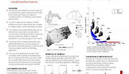
This research introduces model input data reduction using the discrete wavelet transform to the hydrological...
30 Jun 2017
This project aims to use hydrologic models and data assimilation theory to estimate catchment wide rainfall.
Linked Projects
A/Prof Valentijn Pauwels


