PUBLICATIONS
Published works

Evaluation of the feasibility and benefits of operational use of alternative satellite data in the Australian Flammability Monitoring System to ensure long-term data continuity
| Title | Evaluation of the feasibility and benefits of operational use of alternative satellite data in the Australian Flammability Monitoring System to ensure long-term data continuity |
| Publication Type | Report |
| Year of Publication | 2018 |
| Authors | Yebra, M, van Dijk, A, Cary, GJ |
| Date Published | 12/2018 |
| Institution | Bushfire and Natural Hazards CRC |
| City | Melbourne |
| Report Number | 448 |
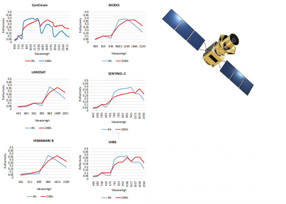
| Abstract | The Australian Flammability Monitoring System (AFMS) is the first, continental-scale prototype web service providing spatial information on Live Fuel Moisture Content (FMC) and landscape flammability conditions derived from satellite observations. The system uses data from the MODIS (MODerate resolution Imaging Spectrometer) instruments on board the Terra and Aqua satellites, providing estimates of FMC and flammability over a fortnight leading up to the day of interest and at 500 m spatial resolution. The Terra and Aqua satellites have already exceeded the expected lifetime and, at some point in the not-too-distant future, will become inoperative. To support the AFMS continuity and redundancy strategy, we evaluate the feasibility and relative benefits of using alternative remote sensing imagery in the AFMS to provide finer spatial and temporal resolutions. The evaluated data sources include the geostationary Japanese Himawari-8 satellite (10min, 2km), the European Sentinel-2 (5 days, 20 m), the Landsat (16 days, 30m) and VIIRS (daily, 750 m) satellites. We use Radiative Transfer Models to build a database of simulated spectra for the different studied sensors and corresponding to different FMC conditions. The database is then used to test the suitability of the different sensor to retrieve FMC based on their different spectral characteristics and goodness of retrieval (e.g. r2 and RMSE between retrieved and modelled). VIIRS obtained the highest accuracy retrieval (r2=0.8, RMSE=19%, n=6178) followed by Sentinel-2 (r2=0.8, RMSE=23, n=6178), Landsat-8 (r2=0.8, RMSE=24, n=6178) and Himawari-8 (r2=0.7, RMSE=24, n=6178). These results were expected as VIIRS has a larger number of sensor bands (5 bands) in the Short Wave Infrared (SWIR) followed by Sentinel-2 (3 bands), Landsat and Himawari-8 (two bands each). VIIRS, therefore, is likely the best candidate to ensure the AFMS website data provision continuity. Sentinel-2 (3 bands) and Himawari-8 are the best second and third candidates that obtain similar accuracies while increasing the spatial (Sentinel-2, 20m) and temporal (Himawari-8, 10 minutes) resolutions of the products displayed in the AFMS. Future work will focus on integrating estimates from these different data sources to better support a range of fire management activities such as prescribed burning and pre-positioning of firefighting resources and inform the future National Fire Danger Rating System. |
Published Works


