Research leader

Harald Richter
Dr Harald Richter Research Leader

Research team

Beth Ebert Research Team
Jeff Kepert
Dr Jeff Kepert Research Team
Craig Arthur Research Team
Martin Wehner Research Team
Mark Edwards
Mark Edwards Research Team
Russell Hay Research Team
Dr Jane Sexton Research Team
Shoni Maguire Research Team
Serena Schroeter Research Team
Claire Krause Research Team

End User representatives

Roger Mentha End-User
Steven Hadley End-User
David Grant End-User
Simon Louis End-User
Paul Bierman End-User
Steve Gray End-User
Oliver Smith End-User
Tony Day End-User
Brian Foo End-User
Graeme Wynwood End-User
Andrew Stark
Andrew Stark End-User
Tamsin Achilles End-User
Steven Hayes End-User

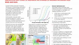
This project set out in 2017 to demonstrate a pilot capability to deliver wind and rain impact forecasts for residential housing from an ensemble of weather prediction models runs. The project was a collaborative effort between the Australian Bureau of Meteorology (Bureau) and Geoscience Australia (GA).

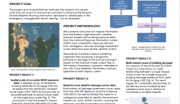
The project was initially focused on the wind and rainfall impact from the 20-22 April 2015 east coast low event in New South Wales (Wehner and Maqsood 2015). The wind and rainfall hazard data were provided by a 24-member ensemble of the Australian Community Climate Earth System Simulator (ACCESS; Bureau of Meteorology 2018) model on a 1.3 km grid, with damage data provided by NSW State Emergency Services (SES) and the Emergency Information Coordination Unit (EICU. Exposure data were sourced from the National EXposure Information System (NEXIS; Nadimpalli et al. 2007; Power et al. 2017) at GA. Heuristic wind vulnerability functions, derived in a previous project, were also provided by GA, while no large-scale rain vulnerability relationships existed.

Through the utilisation of GA’s HazImp software, the research team developed and tested a workflow that integrated the numerical weather forecasts, vulnerability relationships and exposure data at the community level, and early in the second year of the project, they started producing the first spatial quantitative wind impact plots.

The project set up the end-to-end workflow from wind hazard to spatial impact. These spatial impact outputs were delivered into the Visual Weather system at the Bureau of Meteorology, foreshadowing the possibility of easily achievable future visualisation to operational meteorologists.

To evaluate the performance of the quantitative wind impact forecast that the research had produced, very careful and detailed processing of the available damage data was needed to remove damage reports due to tree fall, as opposed to structural failure, rain ingress, and flood inundation. The research has shown that the inclusion of exposure and vulnerability information can outperform a wind impact forecast that only uses a plain wind hazard prediction. In other words, the Dungog case study suggests that the extra effort needed for the quantitative inclusion of exposure and vulnerability information is a promising approach in the pursuit of future quantitative impact forecasts in Australia.

Read the final report here.

Year Type Citation
2022 Book Chapter Golding, B. et al. Towards the “Perfect” Weather Warning: Bridging Disciplinary Gaps through Partnership and Communication 149 (Springer Nature, 2022). doi:doi.org/10.1007/978-3-030-98989-7_6
2021 Report Richter, H. et al. Impact-based forecasting for the coastal zone: East Coast Lows - final project report. (Bushfire and Natural Hazards CRC, 2021).
2020 Report Richter, H. et al. Impact-based forecasting for the coastal zone – East Coast Lows: annual report 2019-2020. (Bushfire and Natural Hazards CRC, 2020).
2020 Report Richter, H. et al. Report on the second end-user workshop – Impact-based forecasting for the coastal zone: East Coast Lows. (Bushfire and Natural Hazards CRC, 2020).
2019 Conference Paper Zovko-Rajak, D., Tory, K. J. & Kepert, J. A case study of South Australia's severe thunderstorm and tornado outbreak . AFAC19 powered by INTERSCHUTZ - Bushfire and Natural Hazards CRC Research Forum (Australian Institute for Disaster Resilience, 2019). at <https://knowledge.aidr.org.au/resources/australian-journal-of-emergency-management-monograph-series/>
2019 Conference Paper Richter, H. et al. The physical impact of strong winds and heavy rain on residential housing: a pilot study. Bushfire and Natural Hazards CRC Research Day AFAC19 (2019). at <Research in the social science area have pointed out that "traditional" hazard-based forecasts and warnings may not be well understood so that mitigating actions for the protection of life and property are not taken (Demuth et al. 2012). The extension of >
2019 Report Richter, H. et al. Impact-Based Forecasting for the Coastal Zone: East Coast Lows- Annual Report 2017/2018. Impact Based Forecasting for the Coastal Zone: East Coast Low 1-28 (2019).
2018 Conference Paper Bates, J. Research proceedings from the 2018 Bushfire and Natural Hazards CRC and AFAC Conference. Bushfire and Natural Hazards CRC & AFAC annual conference 2017 (Bushfire and Natural Hazards CRC, 2018).
2018 Conference Paper Richter, H. et al. Impact-based forecasting for the coastal zone. AFAC18 (Bushfire and Natural Hazards CRC, 2018).
2017 Conference Paper Rumsewicz, M. Research proceedings from the 2017 Bushfire and Natural Hazards CRC and AFAC Conference. Bushfire and Natural Hazards CRC & AFAC annual conference 2017 (Bushfire and Natural Hazards CRC, 2017).
Impact forecasting: what does the forecast mean?
29 Jun 2017
This project will develop a pilot capability to predict impacts of extreme wind and rainfall on the built...
Impact-based forecasting for the coastal zone
19 Sep 2018
Developing a pilot capability to estimate the impacts of East Coast Low hazards on the built environment,...
27 Aug 2019
To develop a pilot capability for making useful predictions of community impacts of extreme wind & rain...
31 Aug 2020
Key findings: A better understandingof the built environmentcanimprove forecasts of wind impact on...